")
")
")
")
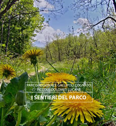 The park has a deep net of itineraries, able to meet both the needs of expert hikers and of those who like simple walks, to live close to an uncontaminated nature.
The main nucleus of the services of the Park is located in Palazzo, not far from Accettura, along the Provincial road that connects Basentana Highway to Accettura. This place also represents the starting point of many visits and excursions and the ideal site for educational activities.
To obtain a detailed description of the itineraries, please choose one the itinerary in the list below. The description refers to general information, technical data, a pdf schedule and the GIS file, the altimetry profile, the journey information and the interactive map.
A map and a general guide of the itineraries are also available.
This itinerary moves along forest of oaks, maples and limes, through agreeable depressions where...
This itinerary, rich in suggestive viewing spots, offers the opportunity to learn a lot about the...
This itinerary is quite interesting from a landscape point of view: it develops in the territory...
This itinerary, rich in suggestive viewing spots, offers the opportunity to learn a lot about the...
This path crosses areas very interesting from an environmental, historical and archaeological...
This forest path develops along the ridge and the east side of Mount Malerba. The itinerary...
This itinerary presents some section in common with itinerary 701 and 706.The path develops in a...
This itinerary moves among open space and cultivated areas, touching the town of Oliveto Lucano....
This itinerary, rich in lookout point, gives the opportunity to observe the whole landscape...
This path, peculiar for its landscape and nature, moves along the ridges of the Dolomiti Lucane,...
This ring path strays along the ridges surrounding the town of Castelmezzano. Crossing the typical...
This ring path begins and ends in small rural settlement located along the farm track Santa...
The route starts along the provincial road to Accettura, 2 km far from the Directional Centre of...
This ring route starts and ends at the Directional Centre of the Park. The path develops almost...
The route 715 moves in a ring form, starting and ending in the town of Accettura. The route allows...
This itinerary moves along the medium Basento valley until to reach the northeast part of the...
This ring itinerary starts the urban area of Oliveto Lucano and moves along the ravines that...
This ring route, moving at the top of Tempa Cortaglia, intersects in its starting point the main...
The starting point of this itinerary is located almost 3.5 km far from Accettura, along the route...