")
")
")
")
This ring path strays along the ridges surrounding the town of Castelmezzano.
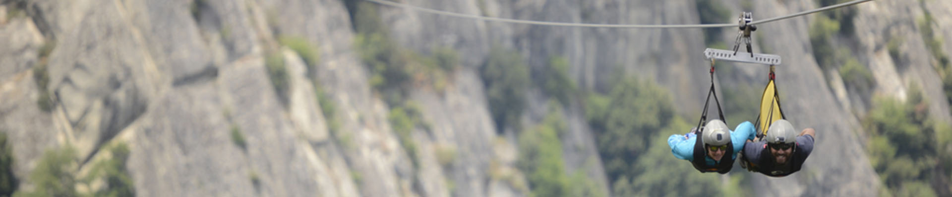
Crossing the typical alleys of one of the most beautiful village of Italy, the path climbs up to the ridge where there is the starting point of “Volo dell ‘Angelo”. Along this itinerary, it is possible to enjoy many different landscapes over the valleys of Basento and Caperrino and it is easy to observe flora and fauna species of high conservation value.
ITINERARY INFORMATION
| Starting point: Lat. 40.5293 Lon. 16.0454 | Journey time: 2 hours | |
| Length: 4,20 Km | Journey modalities: on foot, on horseback | |
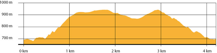
| Difficulty: T (easy) | Slope: max: 44% / med: 14 % | |
| Height (a.s.l.): min: 803 mt. / med: 922 mt. / max: 998 mt.. | Characteristic: S (Historical Naturalistic) |
INFORMATION TOOLS
Pdf file of the itinerary and GIS file to open in Google Earth
Itinerary n. 711 - GIS
Itinerary n. 711
ALTIMETRY PROFILE
Information about the altimetry of the itinerary
ITINERARY
The first part of the itinerary unfolds in the urban area of Castelmezzano along Via Michele Volini up to Piazza Caizzo and, from here, along Corso Vittorio Emanuele II until Palazzo Ducale.Once overcome this building, turn left along Vico De Lerma, leaving the urban area following a causeway road. After 750 mt., turn right, taking another causeway alley. Continue up to the ridge until you reach the path leading to the starting point of Volo dell ‘Angelo.
Turn left and follow the path for almost 850 meters, until you reach the Provincial road that joins Castelmezzano to the Basentana Highway.Continue for 400 meters until you reach an intersection: turn right and take the white road that leads to the ridge in Contrada Arioso. Turn again right, going back to the village, following the ridge.Reach the highest point of the itinerary and then go down to St. Mary’s Chapel.
Once reached the church, continue for 200 meters and then turn right.Follow the causeway road to the urban area, until you reach the starting point.